Tides at Birling Gap and Beachy Head
The tides observe a twelve hour cycle - 6 hours flowing out and 6 hours flowing in, twice a day.
The peak height of the tide is known as Mean High Water and can range from somewhere between 5.6m and 7.9m at its highest, above chart datum.
The lowest tide is know as Mean Low water which can range from 2.2m to 0.7m at its lowest, above chart datum.
Chart datum is the reference to the point from tides are measured.
Eastbourne Council publish tide tables every year which is useful for predicting the tide heights throughout the calendar year.
The following slideshow is an example of tide flow during the twelve hour tide phase*
-
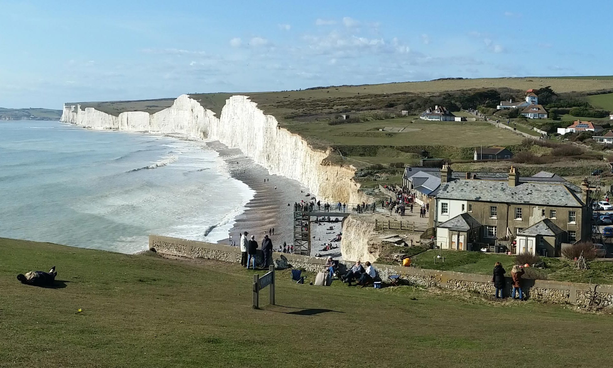
High Tide
-
Birling Gap One Hour After High Tide
-
Birling Gap Two Hours After High Tide
-
Birling Gap Three Hours After High Tide
-
Birling Gap Four Hours After High Tide
-
Birling Gap Five Hours After High Tide
-
Birling Gap Low Tide
-
Birling Gap Five Hours Before High Tide
-
Birling Gap Four Hours Before High Tide
-
Birling Gap Three Hours Before High Tide
-
Birling Gap Two Hours Before High Tide
-
Birling Gap One Hour Before High Tide
Tide tables for
Tuesday, 21 July 2026
Location: Birling Gap4:39 - High Tide (6.27m)
11:19 - Low Tide (1.45m)
17:05 - High Tide (6.39m)
23:45 - Low Tide (1.69m)
11:19 - Low Tide (1.45m)
17:05 - High Tide (6.39m)
23:45 - Low Tide (1.69m)
Take Care
When planning any beach adventure, please take care. When the tide is receding the rocks will be still wet and can be very slippery and quite treacherous. Mind your step and wear good footwear.
If you're planning a trip of any distance, always make sure you have enough time and preferably embark when the tide is going out to give yourself enough time to complete your journey.
*Please note the following:
Forecast tide tables are always predicted and are not always exact
The above animation is not entirely accurate as it does not plot wave heights at various points of the beach which would require much more detailed surveys, it is just an animation as an example to show tide flow.
Tide heights will depend on the time of year and a deviation of up to 2 metres or more can be expected.
This means that you can get 'low' high tides and 'high' high tides and the difference in how much beach is accessible is significant.
It also means you can get 'low' low tides and 'high' low tides which is also significant for being able to reach wrecks such as the Coonatto or be able to walk around the Beachy Head lighthouse.