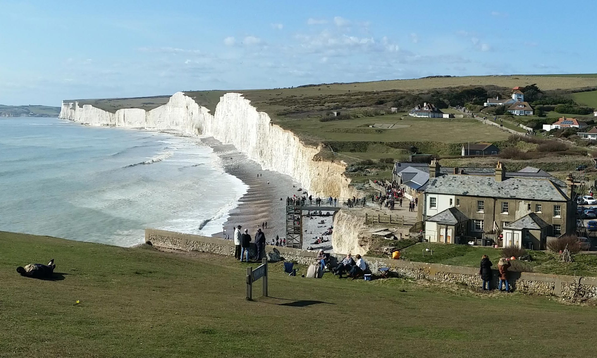
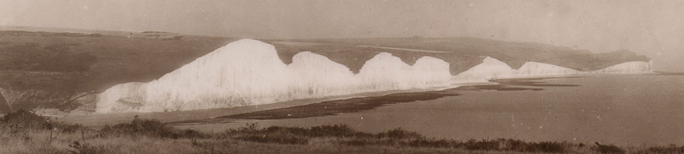
The chalk cliffs are between 65 to 100 million years old.
They were formed when warm tropical seas covered the area and over millennia the remains of coccoliths, tiny sea creatures died and their skeletons built up over millions of years to give us the dense chalk cliffs that we have today.
England and France were once connected, where animals could roam and people could walk on a continuous bridge of land.
It is believed that around 400,000 years ago there was a huge mega-flood that carved what was the start of the English Channel between England and France.
Although the Channel had now been formed, the area consisted of a low lying fertile tundra. At the end of the last ice age meltwater from the North Sea flooded the land, increasing the size and flow of the channel and thereby contributing to the ongoing process of coast erosion.
Did you know?
You can still see the remains of the prehistoric forests at Pett Level near Camber.
Estimations and Calculations
The current average rate of erosion is around 60cm per year.
60cm per year equates to 6 metres over 10 years and 60 metres over 100 years.
This works out at around 600 metres over a thousand years.
By making this assumption, this means that 6,000 years ago, the cliff extended 3.6 kilometres.
Taking this further, to 12,000 years ago this works out at 7.2 kilometres.
The shortest distance across the channel is from Dover to Calais which is 33.1 kilometres or 20.6 miles.
By taking this numbers literally, it means that we are missing quite some distance of land.
One of the things we need to do first of all is to divide 33.1 kilometres by two as the effect of erosion will be affecting both halves of the channel. Therefore the rate of erosion on the cliffs of France will be the same as they are for England. This works out at 16.55 km.
As global warming is contributing to the rate or erosion, we can make this assumption over time, that it must have increased at a continuous rate. Plus we don’t know how big the original mega-flood was or whether the initial flood of meltwater from the North Sea was a disastrous torrent of water or a small trickle, so we don’t actually know how big the original channel was to start with or an actual start date.
We can play around with the numbers on that basis and basically get it to fit, however, this doesn’t change the fact that the current average is 60 cm per year.
The rate of erosion at Birling Gap is much quicker due to the cliffs at this point being made up mostly of Coombe Rock.